DAHAGRAM
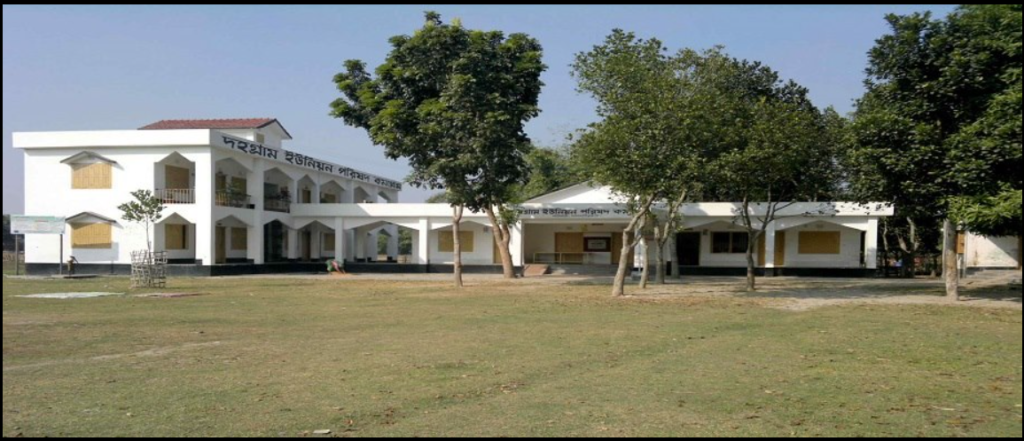
Dahgram Union is a union of Patgram upazila in Lalmonirhat district of Bangladesh and one of the largest enclaves of Bangladesh, located within the Indian mainland. Cooch Behar district of the Indian state of West Bengal on three sides, Teesta river on one side, Indian territory on the other side of the river. Due to geographical reasons it is popularly known as Dahgram-Angorpota enclave. The total area of this union is 22.68 square km. And the total population is about 20,000 people. In 1985, Dahgram and Angarpota enclaves were jointly declared as an independent union (Dahgram Union) of Patgram Upazila. Union Parishad was inaugurated here on August 19, 1989.
Tin Biga Koridor
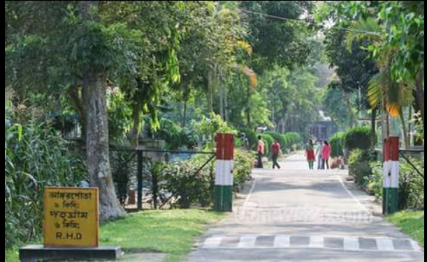
The tin biga koridor is a distinct strip of land on the Bangladesh–India border that lies within the three Bigha area owned by India. It was leased to Bangladesh in September 2012 to facilitate traffic in the Dahgram-Angrapota enclave of Bangladesh. It is located on the border of Mekhligonj subdivision of Cooch Behar district of West Bengal, India and Patgram upazila of Lalmonirhat district of Bangladesh.
Dhagram government High school
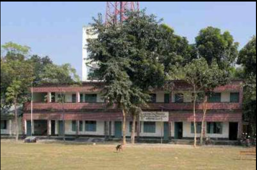
Dhagram Government High School, located in the serene village of Dhagram, stands as a proud institution with a legacy of fostering academic excellence and holistic development. Established several decades ago, the school has become a central pillar of the community, nurturing the intellectual and personal growth of students from diverse backgrounds.
Dahagram 10 bed Hospital
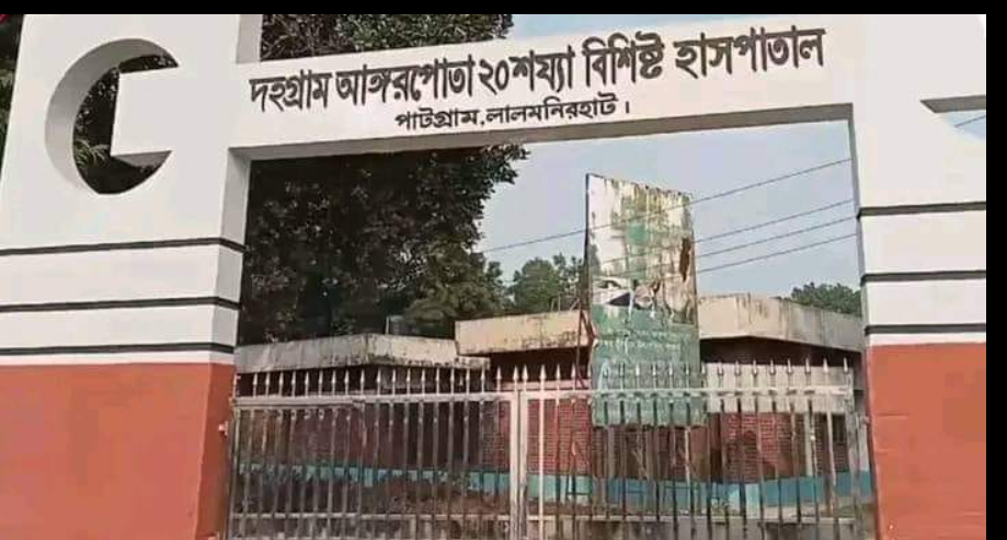
Dahagram 10-Bed Hospital is a vital healthcare facility located in the remote Dahagram-Angorpota enclave, a geographically unique region within Bangladesh near the Indian border. As the only healthcare institution in this isolated area, the hospital plays a crucial role in providing accessible medical care to its population, which often faces challenges due to its geographical and logistical limitations.
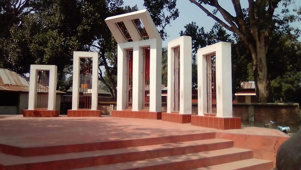
Dhagram Shaheed Minar
Dhagram Shaheed Minar is a symbol of immense cultural and historical significance, dedicated to the memory of those who sacrificed their lives for the Bengali language during the Language Movement in 1952. Located in the heart of Dhagram, this monument embodies the spirit of the Language Martyrs’ Day, also known as International Mother Language Day, which is observed annually on February 21
Visit Our Dahagram
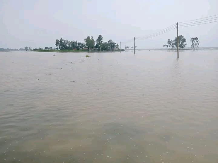
Teesta River
The Teesta River, flowing through the picturesque region of Dhagram, is a vital watercourse in the northeastern part of the Indian subcontinent. Originating from the eastern Himalayas in Sikkim, the river runs through the Indian states of Sikkim and West Bengal, before entering Bangladesh, where it ultimately joins the Brahmaputra. Dhagram, a small yet significant settlement, lies along the banks of this river, with the Teesta playing a crucial role in the area’s ecology, economy, and culture.
In Dhagram, the Teesta is not only a source of livelihood but also an essential part of the social fabric. The river supports agriculture, which is the primary occupation of the local people, by providing irrigation to the fertile plains surrounding the village. Rice, maize, and a variety of vegetables thrive on these alluvial soils, making the region agriculturally rich. Additionally, the river sustains the local fishing industry, offering a variety of freshwater fish that contribute to the diet and economy of the area.
Teesta’s swift currents make it a popular destination for adventure sports such as white-water rafting, which attracts tourists, adding a boost to the local economy. The natural beauty of the river, with its meandering course, lush green banks, and panoramic views of the surrounding hills, makes Dhagram a hidden gem for nature lovers.
However, the Teesta River is also a subject of geopolitical significance, as both India and Bangladesh rely on its waters. The ongoing discussions regarding water-sharing agreements have a direct impact on the livelihoods of people in Dhagram, who depend on the river for their day-to-day survival.
In essence, the Teesta River in Dhagram is not only a geographical landmark but also a lifeline that shapes the economic, social, and cultural identity of the region.
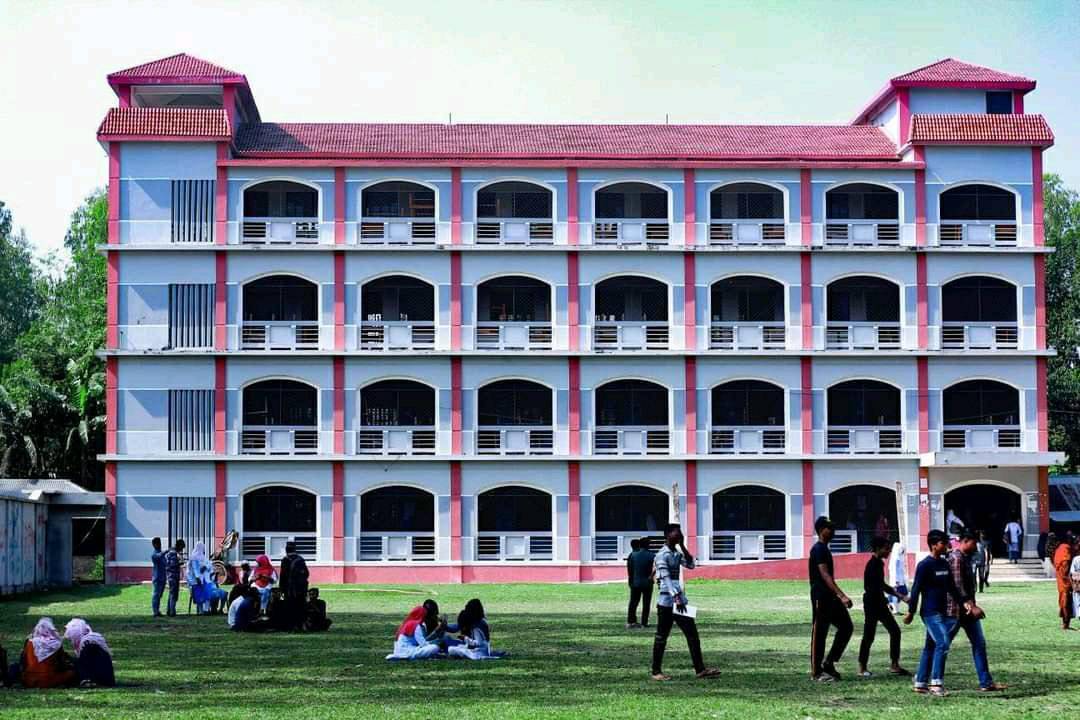
Dhagram government High school
Dhagram Government High School: A Beacon of Learning and Growth
Dhagram Government High School, located in the serene village of Dhagram, stands as a proud institution with a legacy of fostering academic excellence and holistic development. Established several decades ago, the school has become a central pillar of the community, nurturing the intellectual and personal growth of students from diverse backgrounds.
The school caters to students from grades 6 to 10, offering a well-rounded curriculum that aligns with national educational standards. The dedicated faculty, composed of experienced and passionate educators, is committed to providing quality instruction in core subjects such as mathematics, science, literature, social studies, and information technology. The school also places a strong emphasis on extracurricular activities, ensuring that students develop both intellectually and socially. Sports, arts, debates, and cultural programs are integral to the school’s ethos, promoting creativity, teamwork, and leadership.
One of the standout features of Dhagram Government High School is its commitment to inclusivity. The school strives to provide equal learning opportunities for all students, irrespective of their socioeconomic background. Scholarships and financial aid are available for deserving students, ensuring that financial barriers do not hinder access to education. The school’s mission is to empower young minds to think critically, solve problems, and contribute positively to society.
The infrastructure of Dhagram Government High School is continually being improved to meet the needs of modern education. Classrooms are spacious and well-ventilated, creating an optimal learning environment. The school also boasts a well-equipped science laboratory, a computer room with internet access, and a library stocked with books and resources that cater to the educational needs of students.
The leadership at Dhagram Government High School, along with the support of the local community, plays an instrumental role in ensuring that the school remains a vibrant learning environment. Annual school events, parent-teacher meetings, and community involvement further strengthen the bond between the school and the residents of Dhagram.
In conclusion, Dhagram Government High School continues to uphold its mission of educating young minds and preparing them for a bright future, contributing significantly to the development of the local community.
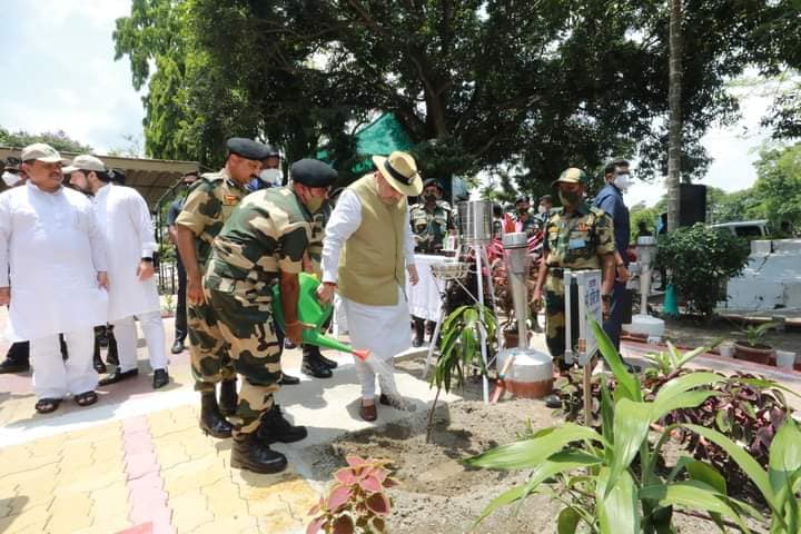
Tin Biga Koridor
According to the Indira Gandhi-Sheikh Mujibur Rahman Agreement of 16 May 1974, India and Bangladesh transferred sovereignty over the Tinbigha Corridor (178 by 85 meters (584 ft × 279 ft)) and South Berubari (7.39 square kilometers (2.85 sq mi)) to each other. by doing As a result, the transportation facilities of Dahgram-Angarpota and Dakshin Berubari are created in their enclaves in both the countries respectively. In 1974, Bangladesh immediately handed over South Berubari to India as per the agreement. However, handing over the Three Bigha Corridor to Bangladesh required an amendment to the Indian Constitution, which was not possible due to political reasons.[2][3]
Later, after much opposition from the Bangladesh government, in 2011 India leased it to the Bangladesh government for a fixed period of time instead of giving it fully to Bangladesh on the condition that South Berubari would remain under Indian control at the same time.[4]
The total area of the 12th South Berubari Union is 22.58 square kilometers (8.72 sq mi), of which 11.29 square kilometers (4.36 sq mi) belong to Bangladesh. Also as per earlier partition four enclaves of Cooch Behar with an area of 6.84 square kilometers (2.64 sq mi) fell to Bangladesh, thus a total area of 18.13 square kilometers (7.00 sq mi) which was to be transferred to Bangladesh. According to the 1967 census, 90% of the total population of these territories belonged to the Hindu religion. On the other hand, the enclave of Bangladesh, Dahgram-Angarpota, was to be handed over to India. It has a total area of 18.68 square kilometers (7.21 sq mi) and according to the 1967 census, 80% of the total population was Muslim. If the handover had been successful, it would have likely sparked ethnic riots. As a result, the people of Berubari opposed this transfer.
After 1971, India proposed to Bangladesh that half of Berubari would be under India and Dahgram-Angarpota would remain in Bangladesh. According to this agreement, India leased a three-bigha area to the people of Dahgram-Angarpota to maintain communication with the mainland of Bangladesh. It was adopted by the Government of Bangladesh and carefully cordoned off around the Tinbigha. An agreement was signed between Indira Gandhi and Sheikh Mujibur Rahman on 16 May 1974 and finally ended the Berubari dispute as per Article 1.14. According to the agreement: “India will control the southern half of South Berubari with an estimated area of 6.8 square kilometers (2.64 sq mi) and in return Bangladesh will control Dahgram-Angarpota. India will give Dahgram-Angarpota a 178 by 85 m (584 ft x 279 ft) area will be leased to Bangladesh.”
Historical Dahagram
Dahagram Union is a union of Patgram upazila in Lalmonirhat district of Bangladesh and one of the largest enclaves of Bangladesh, located within the Indian mainland. Cooch Behar district of the Indian state of West Bengal on three sides, Teesta river on one side, Indian territory on the other side of the river. Due to geographical reasons it is popularly known as Dahgram-Angorpota enclave. The total area of this union is 22.68 square km. And the total population is about 20,000 people. In 1985, Dahgram and Angarpota enclaves were declared together as an independent union (Dahgram Union) of Patgram Upazila. Union Parishad was inaugurated here on August 19, 1989.
History
After the Bangladesh War of Independence, an agreement was signed between the governments of India and Bangladesh to settle the Chit Mahal dispute. But this agreement was not implemented, and the dispute over Dahgram continues to this day. A new agreement was signed in 1982, which came into effect in 1992. According to this agreement, India leased a 178 by 85 m (584 ft × 279 ft) piece of land to Bangladesh, now known as the Tinbigha Corridor, to connect the people of Dahgram-Angarpota with the Bangladeshi mainland.
Earlier the corridor was kept open for 12 hours a day, [in which the residents of Dahgram-Angarpota had to face severe problems as there were no hospitals and educational institutions at that time.
The corridor is currently open 24 hours as per an agreement between the Prime Minister of Bangladesh and the Prime Minister of India in Dhaka on 6 September 2011.
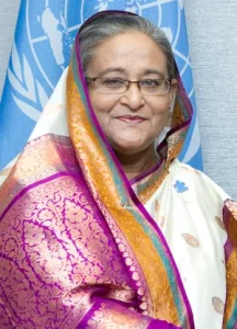
The corridor was officially declared open by Bangladesh Prime Minister Sheikh Hasina on 19 October 2011.
Infrastructure
Before 2011, there was no hospital or college in Dahgram-Angarpota. On October 19, 2011, Prime Minister Sheikh Hasina inaugurated a ten-bed hospital and Dahgram Union Parishad in Dahgram.

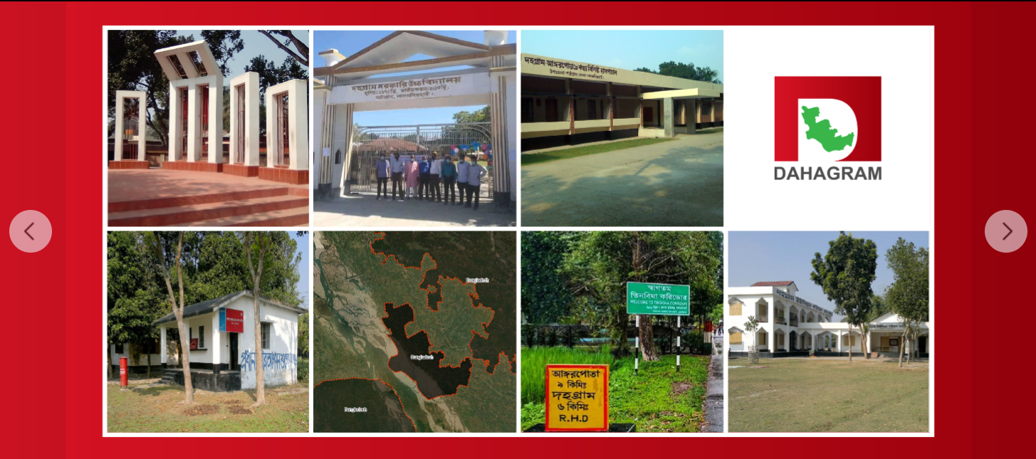
Welcome to Dahgram Union Three Bigha Corridor. Dahgram is a very interesting and historical place that you must visit if you hear about it. Dahgram is a union between India and Bangladesh, located in Patgram Upazila, Lalmonirhat District. Dahgram is very important for geographical reasons, it is a union of Bangladesh which has a great impact on the economy of Bangladesh.
